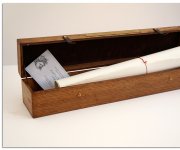
World map of the Venetian cartographer Giovanni Andrea Vavassore, facsimile
|
Opera di Giouãni andrea Vauassore ditto Vadagnino
|
|
World map of the Venetian cartographer Giovanni Andrea Vavassore – is a real jewel of cartographic art. It is extremely rare: the world remained five or six copies, and not all of them have a full image.
The name of Giovanni Andrea Vavassore is associated with a number of strategic maps; he is the author of the first printed nautical chart (the Eastern Mediterranean, 1539). Usually Vavassore’s publications were not rich in the latest geographic information, but were qualitatively different in aesthetic terms.
Republic of Venice affected dramatically the early period of the development of cartography. Early in the 16th century, in Venice Marco Beneventano produced new maps for the "Geography" of Ptolemy, published in Rome in 1507, and it was the eighth edition of the product of the Greek geographer (the first printed "Geography" of Ptolemy was published in 1477 in Bologna).
Each successive edition differs from previous new interpretations of classic maps, as well as the advent of newer maps. Next "Geography", which was published in Venice in 1511, is an especially beautiful map by Bernard Sylvanus, a map of Giovanni Andrea Vavassore which is based on it, is shown on the map. Unfortunately, the map is not dated, according to some sources it was printed in the 1530s or the 1540s, to other – it could have been made even earlier, in 1522.

|

|

|

|

|

|

|

|
The map is in an oval projection. Land between the Black and Baltic Seas are signed as SARMATIA DEVROPA, the Dnepr River (boristene f.), the Western Dzvina and the Don (Tanai fiu) are pointed there and take their beginning from mythical mountains called Ripher monte. The Dnepr is present on the map also as the name of one of the climate zones per boristene, this eloquent fact shows the involvement of the surrounding regions in the life of the ancient world.
The cost of a geographical map of the world of the first half of the 16th century is often measured by the fact how the New World is shown. On Opera di Giouãni Andrea Vauassore we can see mundus nouus, terra sanctae crucis, terra cube, isu ispaniarum.
Earth's bullet is blown by 12 Winds: Septentrione Borea, Aquilonc, Licia, Subsolano, Euro Noto, Austro Noto, Libonoto, Aphrico, Zephiro Etponente, Lauro, Lircio.
Abbreviations, which are present on the map:
f, fiu, fiume – River
m., mon., monte, monti – Mountain
palude – Swamp, lake
meroi – Island
|
Graphic Workshop imago.by – Project of facsimile printing rare maps and engravings on technologies that emerged more than five centuries ago. All work is done manually by masters with all the features of the old tradition. Facsimiles, restored in the workshop imago.by, almost completely correspond to the originals. e-mail:
Этот e-mail адрес защищен от спам-ботов, для его просмотра у Вас должен быть включен Javascript
|
